Railway crossing, Kiln Lane
Introduction
The photograph on this page of Railway crossing, Kiln Lane by Christopher Hilton as part of the Geograph project.
The Geograph project started in 2005 with the aim of publishing, organising and preserving representative images for every square kilometre of Great Britain, Ireland and the Isle of Man.

There are currently over 7.5m images from over 14,400 individuals and you can help contribute to the project by visiting https://www.geograph.org.uk
Railway crossing, Kiln Lane
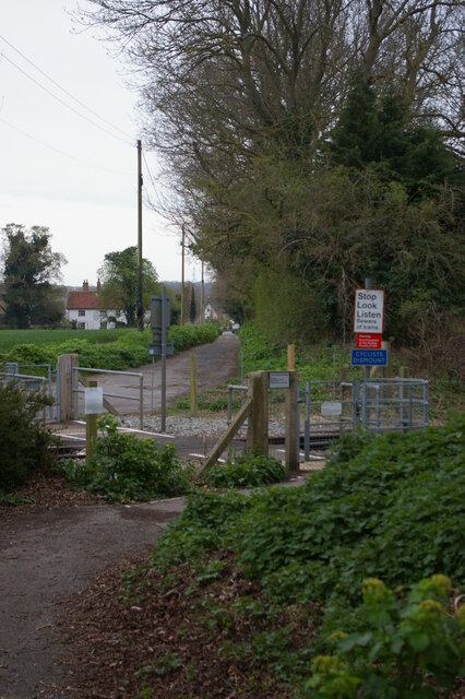
Image: © Christopher Hilton Taken: 12 Apr 2022
Kiln Lane loops in a horseshoe-shape away from and back to the old London-Lowestoft road, crossing the railway twice on the way. Construction of the A12 Saxmundham bypass included creating an access point onto Kiln Lane at its furthest point from the old road, making it possible for the cars to get to houses on the west side of the railway line without using the level crossings; as a result, the southern crossing shown here has been converted to a foot crossing only, and vehicles can no longer use it. The northern crossing, which is very seldom used, can be seen at Image and Image
Images are licensed for reuse under creativecommons.org/licenses/by-sa/2.0
Image Location
Latitude
52.201867
Longitude
1.480506