Beith from the air
Introduction
The photograph on this page of Beith from the air by Thomas Nugent as part of the Geograph project.
The Geograph project started in 2005 with the aim of publishing, organising and preserving representative images for every square kilometre of Great Britain, Ireland and the Isle of Man.

There are currently over 7.5m images from over 14,400 individuals and you can help contribute to the project by visiting https://www.geograph.org.uk
Beith from the air
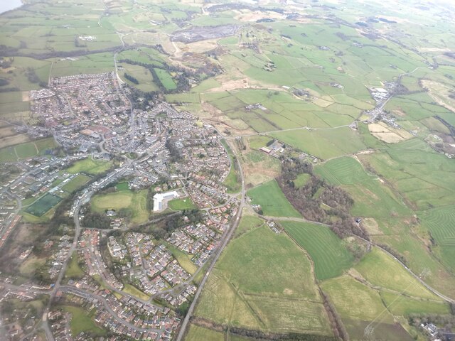
Image: © Thomas Nugent Taken: 7 Apr 2022
The A737 road skirts around the south and east sides of the town. The route of the former Beith branch of the Glasgow, Barrhead & Kilmarnock Joint Railway can be discerned in the foreground. This five mile line closed to passengers in November 1962 and to freight in 1964.
Images are licensed for reuse under creativecommons.org/licenses/by-sa/2.0
Image Location
Latitude
55.743304
Longitude
-4.632259