Uppingham School [4]
Introduction
The photograph on this page of Uppingham School [4] by Michael Dibb as part of the Geograph project.
The Geograph project started in 2005 with the aim of publishing, organising and preserving representative images for every square kilometre of Great Britain, Ireland and the Isle of Man.

There are currently over 7.5m images from over 14,400 individuals and you can help contribute to the project by visiting https://www.geograph.org.uk
Uppingham School [4]
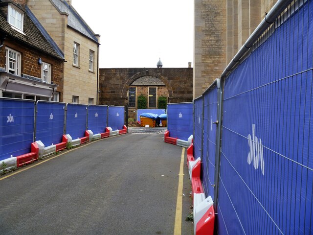
Image: © Michael Dibb Taken: 28 Sep 2021
The buildings of Uppingham School dominate the southern side of High Street West. Seen here at the end of School Lane is this wall of squared, coursed ironstone rubble stone and gateway with a large central carriageway flanked by 2 smaller pedestrian ways all with cast iron gates. Listed, grade II, with details at: https://historicengland.org.uk/listing/the-list/list-entry/1073174 Uppingham School is an independent, co-educational, fee charging school for boarders aged 13 to 18, founded in 1584. Uppingham is a market town in the county of Rutland, and received its charter in 1281. It is located near the border with Northamptonshire, approximately 17 miles east of Leicester and some 20 miles west of Peterborough. The A47 road ran through the town until a bypass was built in 1982.
Images are licensed for reuse under creativecommons.org/licenses/by-sa/2.0
Image Location
Latitude
52.587603
Longitude
-0.72393