Benchmark, Scalegill, Railway Bridge
Introduction
The photograph on this page of Benchmark, Scalegill, Railway Bridge by Adrian Taylor as part of the Geograph project.
The Geograph project started in 2005 with the aim of publishing, organising and preserving representative images for every square kilometre of Great Britain, Ireland and the Isle of Man.

There are currently over 7.5m images from over 14,400 individuals and you can help contribute to the project by visiting https://www.geograph.org.uk
Benchmark, Scalegill, Railway Bridge
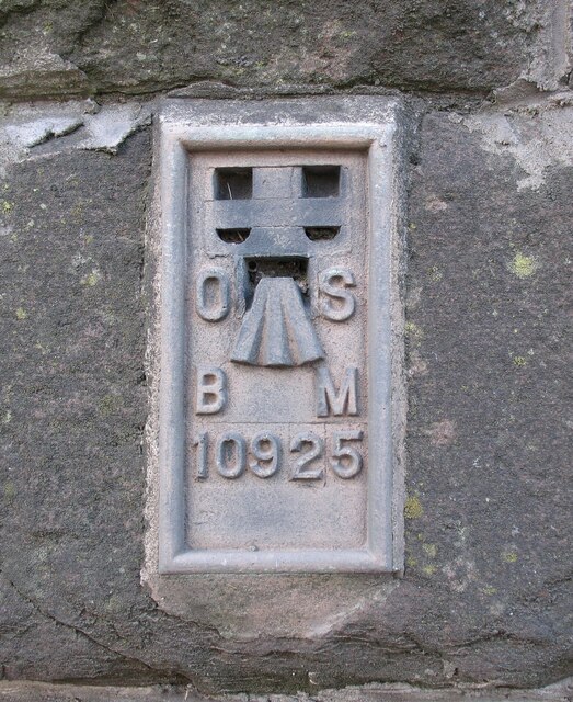
Image: © Adrian Taylor Taken: 22 Aug 2008
Detail of the Ordnance Survey flush bracket benchmark on the railway bridge which carries the A595 road over the former Mirehouse Junction to Moor Row railway near Scalegill. The benchmark marks a height of 66.6317m above mean sea level (Ordnance Datum Newlyn) last levelled in 1961 and verified in 1965 (location photograph Image).
Images are licensed for reuse under creativecommons.org/licenses/by-sa/2.0
Image Location
Latitude
54.51295
Longitude
-3.551857