Smelt Mill Flue Arch
Introduction
The photograph on this page of Smelt Mill Flue Arch by Malcolm Street as part of the Geograph project.
The Geograph project started in 2005 with the aim of publishing, organising and preserving representative images for every square kilometre of Great Britain, Ireland and the Isle of Man.

There are currently over 7.5m images from over 14,400 individuals and you can help contribute to the project by visiting https://www.geograph.org.uk
Smelt Mill Flue Arch
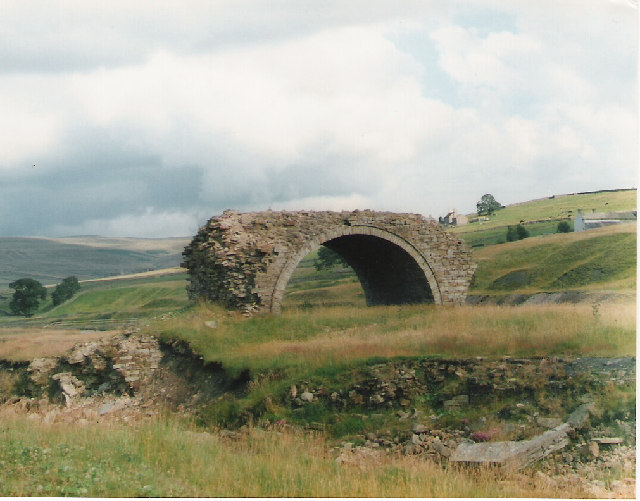
Image: © Malcolm Street Taken: Unknown
This is all that remains of what must have been an enormous structure. This carried an enclosed flue on the top which ran from the smelt mill to the chimney.
Images are licensed for reuse under creativecommons.org/licenses/by-sa/2.0
Image Location


Leaflet Map data © OpenStreetMap
Latitude
54.779157
Longitude
-2.113461