Beneath the awesome Conisbrough Railway Viaduct
Introduction
The photograph on this page of Beneath the awesome Conisbrough Railway Viaduct by Neil Theasby as part of the Geograph project.
The Geograph project started in 2005 with the aim of publishing, organising and preserving representative images for every square kilometre of Great Britain, Ireland and the Isle of Man.

There are currently over 7.5m images from over 14,400 individuals and you can help contribute to the project by visiting https://www.geograph.org.uk
Beneath the awesome Conisbrough Railway Viaduct
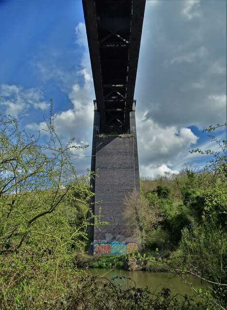
Image: © Neil Theasby Taken: 8 Apr 2022
With The River Don flowing by beneath it. "The magnificent Conisbrough viaduct is impossible to overlook with its 21 arches, 150 foot lattice iron girder span over the river, and 1,527 feet in length. Opened in 1909, it was part of a connection between the Hull & Barnsley Railway and those of the Great Northern and Great Eastern. It consists of more than 15 million bricks, and features some beautiful decorative brickwork." - copied from the "Railway Paths" website.
Images are licensed for reuse under creativecommons.org/licenses/by-sa/2.0
Image Location


Leaflet Map data © OpenStreetMap
Latitude
53.488071
Longitude
-1.210089