Railway line east of Dewsbury Road
Introduction
The photograph on this page of Railway line east of Dewsbury Road by Stephen Craven as part of the Geograph project.
The Geograph project started in 2005 with the aim of publishing, organising and preserving representative images for every square kilometre of Great Britain, Ireland and the Isle of Man.

There are currently over 7.5m images from over 14,400 individuals and you can help contribute to the project by visiting https://www.geograph.org.uk
Railway line east of Dewsbury Road
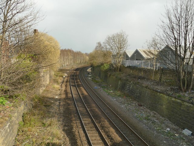
Image: © Stephen Craven Taken: 2 Apr 2022
This is the Leeds to Castleford line which now carries a twice-hourly passenger service to Sheffield or Knottingley, and occasional freight. In the heyday of the railways, this was a four-track main line, with a four-track branch off to the left serving the Midland Railway's Crown Point goods depot where a birch wood has grown up (far left), and nearer the camera a mineral line bringing coal from the Middleton collieries to Leeds gas works crossed the line on a bridge - you can just see the left hand abutment.
Images are licensed for reuse under creativecommons.org/licenses/by-sa/2.0
Image Location


Leaflet Map data © OpenStreetMap
Latitude
53.783807
Longitude
-1.541171