Old Boundary Marker on the B3213 Exeter Road in Ivybridge
Introduction
The photograph on this page of Old Boundary Marker on the B3213 Exeter Road in Ivybridge by J Browne as part of the Geograph project.
The Geograph project started in 2005 with the aim of publishing, organising and preserving representative images for every square kilometre of Great Britain, Ireland and the Isle of Man.

There are currently over 7.5m images from over 14,400 individuals and you can help contribute to the project by visiting https://www.geograph.org.uk
Old Boundary Marker on the B3213 Exeter Road in Ivybridge
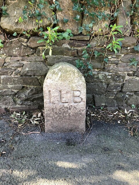
Image: © J Browne Taken: 31 Mar 2022
Municipal Boundary Marker against a stone wall on the south side of the B3213 Exeter Road, formerly the A38, 30 metres east of Springwood Close. Ivybridge parish. ILB is Ivybridge Local Board set up to tackle the problem of sewage disposal within four parishes. Milestone Society National ID: DV_PLEX011apb
Images are licensed for reuse under creativecommons.org/licenses/by-sa/2.0
Image Location
Latitude
50.39081
Longitude
-3.911416