Old Boundary Marker on Cleeve Drive, Ivybridge
Introduction
The photograph on this page of Old Boundary Marker on Cleeve Drive, Ivybridge by T Jenkinson as part of the Geograph project.
The Geograph project started in 2005 with the aim of publishing, organising and preserving representative images for every square kilometre of Great Britain, Ireland and the Isle of Man.

There are currently over 7.5m images from over 14,400 individuals and you can help contribute to the project by visiting https://www.geograph.org.uk
Old Boundary Marker on Cleeve Drive, Ivybridge
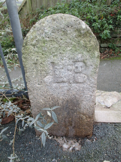
Image: © T Jenkinson Taken: 4 Dec 2019
Parish Boundary Marker set on the footpath above the old road Kennel Lane against metal fencing on the south side of Cleeve Drive 30 metres west of the top end of Blatchford Road. Ivybridge parish. Inscribed ILB for Ivybridge Local Board. Milestone Society National ID: DV_IBSpb
Images are licensed for reuse under creativecommons.org/licenses/by-sa/2.0
Image Location
Latitude
50.393573
Longitude
-3.933588