Durham Viaduct
Introduction
The photograph on this page of Durham Viaduct by David Robinson as part of the Geograph project.
The Geograph project started in 2005 with the aim of publishing, organising and preserving representative images for every square kilometre of Great Britain, Ireland and the Isle of Man.

There are currently over 7.5m images from over 14,400 individuals and you can help contribute to the project by visiting https://www.geograph.org.uk
Durham Viaduct
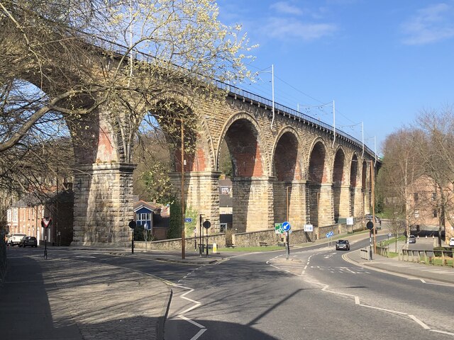
Image: © David Robinson Taken: 27 Mar 2022
Grade II listed railway viaduct, built 1857 for the North Eastern Railway's Durham - Bishop Auckland line. In 1871 the route from Tursdale Junction - Durham - Newcastle was developed and this became the main line from London - Newcastle replacing the route via Leamside. In 1987 the viaduct was cleaned of 130 years of smoke & grime that had built up from the city's housing and industry.
Images are licensed for reuse under creativecommons.org/licenses/by-sa/2.0
Image Location
Latitude
54.777332
Longitude
-1.584727