Old Boundary Marker and Bridge Marker on Dukinfield Bridge, Tameside
Introduction
The photograph on this page of Old Boundary Marker and Bridge Marker on Dukinfield Bridge, Tameside by D Garside as part of the Geograph project.
The Geograph project started in 2005 with the aim of publishing, organising and preserving representative images for every square kilometre of Great Britain, Ireland and the Isle of Man.

There are currently over 7.5m images from over 14,400 individuals and you can help contribute to the project by visiting https://www.geograph.org.uk
Old Boundary Marker and Bridge Marker on Dukinfield Bridge, Tameside
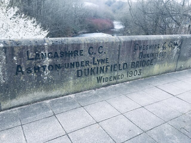
Image: © D Garside Taken: 10 Mar 2022
County Boundary Marker and Bridge Marker inscribed in the southeast parapet of Dukinfield Bridge, River Tame, on the B6170 Whitelands. On the former boundary of Ashton-under-Lyne, Lancashire and Dukinfield, Cheshire but now entirely in an unparished area of Tameside Metropolitan District. See also https://www.geograph.org.uk/photo/45831. Milestone Society National ID: LA_AULDUK02cb
Images are licensed for reuse under creativecommons.org/licenses/by-sa/2.0
Image Location
Latitude
53.484615
Longitude
-2.08946