The Sentinels
Introduction
The photograph on this page of The Sentinels by A J Paxton as part of the Geograph project.
The Geograph project started in 2005 with the aim of publishing, organising and preserving representative images for every square kilometre of Great Britain, Ireland and the Isle of Man.

There are currently over 7.5m images from over 14,400 individuals and you can help contribute to the project by visiting https://www.geograph.org.uk
The Sentinels
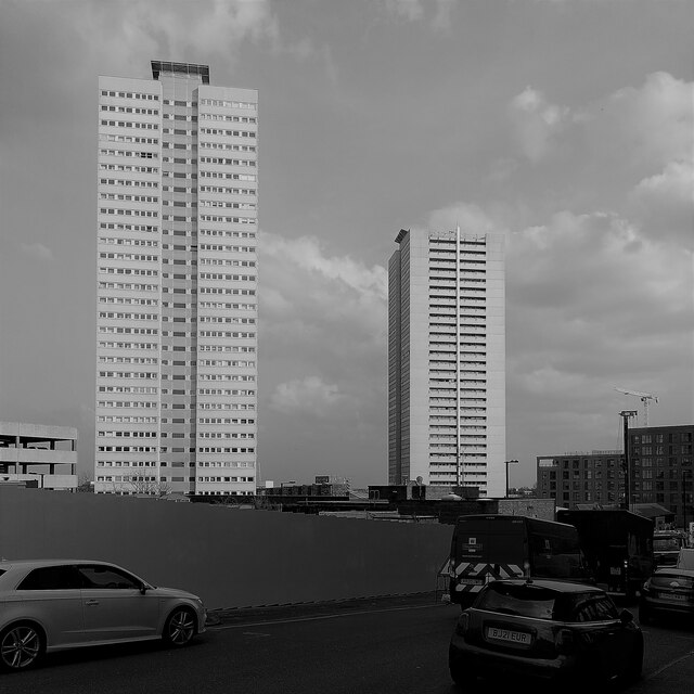
Image: © A J Paxton Taken: 22 Mar 2022
The Sentinels are Cleveland Tower, to the left, and Clydesdale Tower, to the right. They are 32 storeys tall according to the Edinburgh University Tower Block site, which describes them as having 244 dwellings per block, and they were built by the contractor Bryant for the city council of Birmingham https://www.towerblock.eca.ed.ac.uk/development/sentinels . Cleveland Tower was completed in 1970, Clydesdale in 1971, according to Wikipedia, which describes their unusual social history https://en.wikipedia.org/wiki/The_Sentinels . The Sentinels were the highest housing blocks in the city until they were surpassed in 2019. Originally council flats, they are now owned by a housing association. The Sentinels are seen here from Blucher Street off Holloway Head, near the synagogue, a viewpoint which will presumably be lost once the construction in the foreground is completed.
Images are licensed for reuse under creativecommons.org/licenses/by-sa/2.0
Image Location
Latitude
52.474681
Longitude
-1.901905