Old Boundary Marker on the A515 Buxton Road
Introduction
The photograph on this page of Old Boundary Marker on the A515 Buxton Road by M Parsons as part of the Geograph project.
The Geograph project started in 2005 with the aim of publishing, organising and preserving representative images for every square kilometre of Great Britain, Ireland and the Isle of Man.

There are currently over 7.5m images from over 14,400 individuals and you can help contribute to the project by visiting https://www.geograph.org.uk
Old Boundary Marker on the A515 Buxton Road
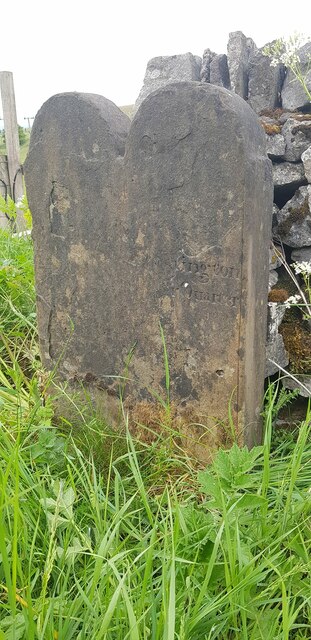
Image: © M Parsons Taken: 25 Mar 2022
Parish Boundary Marker by a wooden stile on the northeast side of the A515 Buxton Road. Hartington Middle Quarter parish. Believed to have been inscribed Townships / of at the top with Chelmorton below and to the left, and Hartington / Upper / Quarter below and to the right. Chelmorton was a chapelry and Hartington Upper Quarter a township, in Bakewell and Hartington parishes respectively, until 1866 when they became parishes in their own right. See also https://www.flickr.com/photos/57365958@N00/5011555593. Milestone Society National ID: DE_CHEHUQ01pb
Images are licensed for reuse under creativecommons.org/licenses/by-sa/2.0
Image Location
Latitude
53.216625
Longitude
-1.853186