A wander around the centre of Coventry [29]
Introduction
The photograph on this page of A wander around the centre of Coventry [29] by Michael Dibb as part of the Geograph project.
The Geograph project started in 2005 with the aim of publishing, organising and preserving representative images for every square kilometre of Great Britain, Ireland and the Isle of Man.

There are currently over 7.5m images from over 14,400 individuals and you can help contribute to the project by visiting https://www.geograph.org.uk
A wander around the centre of Coventry [29]
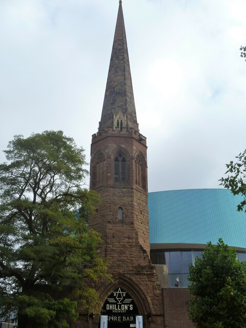
Image: © Michael Dibb Taken: 25 Sep 2021
This 14th century steeple, in New Union Street, is all that remains of the Franciscan friary founded 1234. The rest of the church, which had been rebuilt in 1832, was destroyed by bombing in WWII. Constructed of ashlar. Listed, grade II*, with details at: https://historicengland.org.uk/listing/the-list/list-entry/1076628 Coventry is a large city in the West Midlands, on the River Sherbourne. It is some 16 miles southeast of Birmingham and 85 miles northwest of London. There is evidence of occupation earlier, but the present settlement grew around the abbey of St Mary, founded in 1043, and Coventry became an important medieval city. Over the centuries the principal industries have been weaving, watch making, cycle manufacturing and the production of motor vehicles. The city centre has been almost entirely rebuilt following bombing damage in WWII and includes a new cathedral built in 1962.
Images are licensed for reuse under creativecommons.org/licenses/by-sa/2.0
Image Location


Leaflet Map data © OpenStreetMap
Latitude
52.405758
Longitude
-1.511524