
Gauge House, The Batch, Rickford
Introduction
The photograph on this page of Gauge House, The Batch, Rickford by Jo and Steve Turner as part of the Geograph project.
The Geograph project started in 2005 with the aim of publishing, organising and preserving representative images for every square kilometre of Great Britain, Ireland and the Isle of Man.

There are currently over 7.5m images from over 14,400 individuals and you can help contribute to the project by visiting https://www.geograph.org.uk
Gauge House, The Batch, Rickford
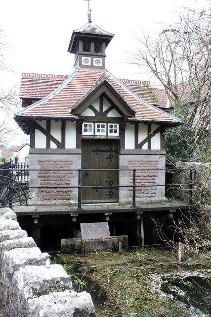
Image: © Jo and Steve Turner Taken: 9 Mar 2022
Grade II Listed late 19th century sluice-house. It was built in 1895 by the Bristol Waterworks Company, beneath which is the sluice controlling the flow of water into the brook. It also controls an underground pipe to Blagdon Lake. Rickford Pond that flows into the brook under the house is fed from Rickford Rising on the opposite side of the road at the south end of the pond that also fed a leat to a flour mill and later a paper mill. The flour mill appears to have been destroyed by fire.
Images are licensed for reuse under creativecommons.org/licenses/by-sa/2.0
Image Location

Latitude
51.330556
Longitude
-2.738273