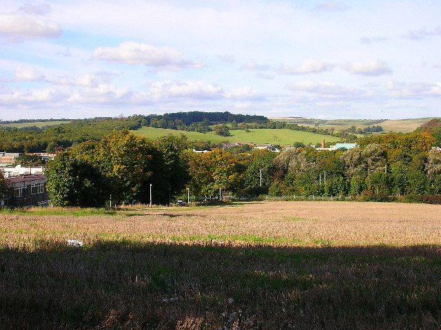
Site of new Brighton football ground, Falmer
Introduction
The photograph on this page of Site of new Brighton football ground, Falmer by Simon Carey as part of the Geograph project.
The Geograph project started in 2005 with the aim of publishing, organising and preserving representative images for every square kilometre of Great Britain, Ireland and the Isle of Man.
There are currently over 7.5m images from over 14,400 individuals and you can help contribute to the project by visiting https://www.geograph.org.uk

Image: © Simon Carey Taken: 9 Oct 2005
Finally given the go ahead this morning (28th October) after a four year battle which included two public inquiries. The functional 60s university buildings to the left will be demolished to make way for part of the stadium. The dip will be excavated to make a bowl in order to minimise impact on the environment. The area already contains both the University of Sussex (behind the trees) and the University of Brighton as well as railway links and the A27(T) dual carriageway which splits the village of Falmer into two distinct parts. The view at the back takes in Ditchling Beacon.
Image Location


