Disused Structure on Pitfour Estate
Introduction
The photograph on this page of Disused Structure on Pitfour Estate by Ian Dodds as part of the Geograph project.
The Geograph project started in 2005 with the aim of publishing, organising and preserving representative images for every square kilometre of Great Britain, Ireland and the Isle of Man.

There are currently over 7.5m images from over 14,400 individuals and you can help contribute to the project by visiting https://www.geograph.org.uk
Disused Structure on Pitfour Estate
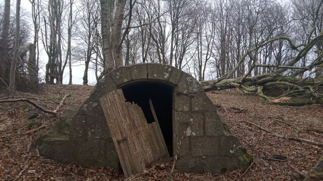
Image: © Ian Dodds Taken: 13 Feb 2022
This low structure is water-related - there were some pipes and what looked like an old ballcock inside. It will no doubt have had something to do with the old reservoirs nearby. Just SouthEast of this spot is a fenced-off area containing a rather mundane new covered reservoir, and a far more impressive (albeit far smaller) curved concrete tank-style one. Strangely, this tiny building makes it onto the current large-scale OS map, but the functioning covered reservoir does not.
Images are licensed for reuse under creativecommons.org/licenses/by-sa/2.0
Image Location
Latitude
57.534108
Longitude
-2.036394