Wagtail
Introduction
The photograph on this page of Wagtail by Trevor Littlewood as part of the Geograph project.
The Geograph project started in 2005 with the aim of publishing, organising and preserving representative images for every square kilometre of Great Britain, Ireland and the Isle of Man.

There are currently over 7.5m images from over 14,400 individuals and you can help contribute to the project by visiting https://www.geograph.org.uk
Wagtail
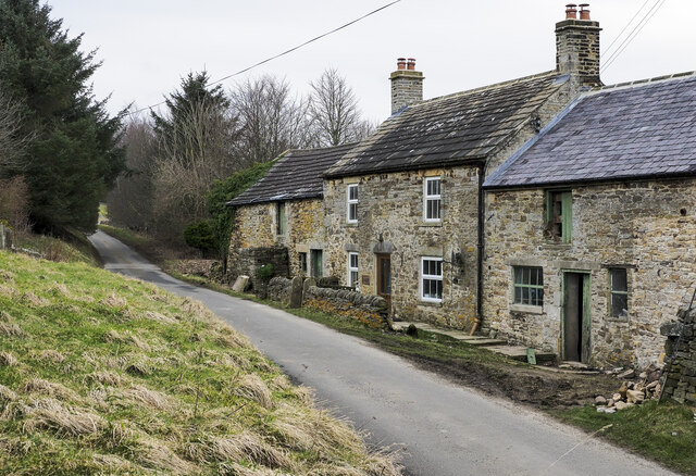
Image: © Trevor Littlewood Taken: 15 Mar 2022
Wagtail is a fairy isolated range of buildings - a house with attached barns - above the south side of the valley of the Nookton Burn, near to Hunstanworth. Some renovation is ongoing: the barn at the right side in the image has recently been reroofed.
Images are licensed for reuse under creativecommons.org/licenses/by-sa/2.0
Image Location
Latitude
54.828147
Longitude
-2.097099