Benchmark, Hermons Hill
Introduction
The photograph on this page of Benchmark, Hermons Hill by Adrian Taylor as part of the Geograph project.
The Geograph project started in 2005 with the aim of publishing, organising and preserving representative images for every square kilometre of Great Britain, Ireland and the Isle of Man.

There are currently over 7.5m images from over 14,400 individuals and you can help contribute to the project by visiting https://www.geograph.org.uk
Benchmark, Hermons Hill
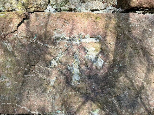
Image: © Adrian Taylor Taken: 12 Mar 2022
Detail of the Ordnance Survey cut benchmark on the corner of a barn at Hermons Hill. The benchmark appears to have been filled and this was possibly done to indicate cancellation when it was superseded by flush bracket benchmark G3100, below this benchmark on the same wall (photograph Image). The 1899 edition Ordnance Survey map shows this benchmark marking a height of 157.9ft above mean sea level, Ordnance Datum Newlyn. Location photograph Image
Images are licensed for reuse under creativecommons.org/licenses/by-sa/2.0
Image Location
Latitude
54.425799
Longitude
-3.382701