Radar domes on Titterstone Clee Hill
Introduction
The photograph on this page of Radar domes on Titterstone Clee Hill by Mat Fascione as part of the Geograph project.
The Geograph project started in 2005 with the aim of publishing, organising and preserving representative images for every square kilometre of Great Britain, Ireland and the Isle of Man.

There are currently over 7.5m images from over 14,400 individuals and you can help contribute to the project by visiting https://www.geograph.org.uk
Radar domes on Titterstone Clee Hill
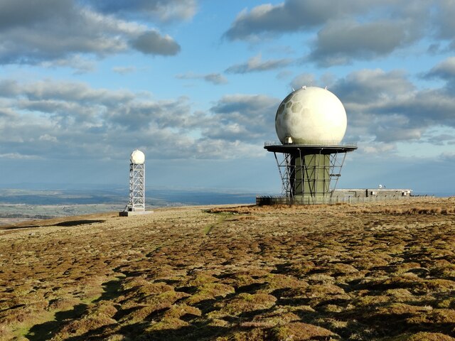
Image: © Mat Fascione Taken: 5 Mar 2022
Titterstone Clee Hill is the third-highest hill in Shropshire at 533m (1,749 ft). The dome on the right is the National Air Traffic Services radar network, on the left is the Met Office weather radar station.
Images are licensed for reuse under creativecommons.org/licenses/by-sa/2.0
Image Location


Leaflet Map data © OpenStreetMap
Latitude
52.398233
Longitude
-2.597533