Storm Arwen chaos at Rothley Crossroads
Introduction
The photograph on this page of Storm Arwen chaos at Rothley Crossroads by Leanmeanmo as part of the Geograph project.
The Geograph project started in 2005 with the aim of publishing, organising and preserving representative images for every square kilometre of Great Britain, Ireland and the Isle of Man.

There are currently over 7.5m images from over 14,400 individuals and you can help contribute to the project by visiting https://www.geograph.org.uk
Storm Arwen chaos at Rothley Crossroads
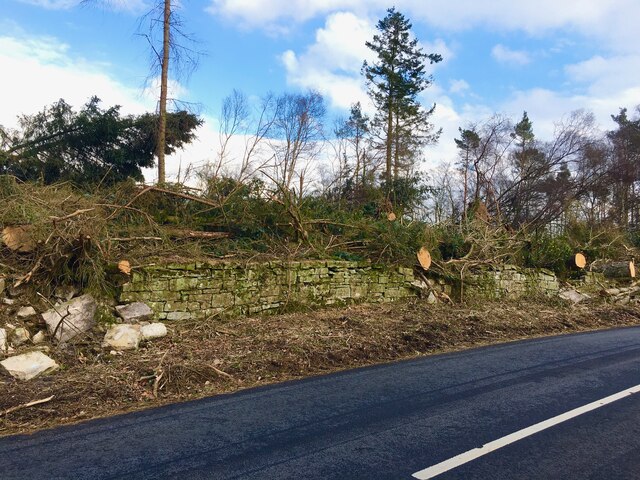
Image: © Leanmeanmo Taken: 10 Mar 2022
Another view of the fallen trees and damage to the drystone wall when Storm Arwen hit. Thin, exposed belts of east - west trees were particularly badly hit by the wind from the north. The 17 or so large trees that were thrown directly across the road must have taken a considerable effort to clear.
Images are licensed for reuse under creativecommons.org/licenses/by-sa/2.0
Image Location
Latitude
55.201091
Longitude
-1.931314