Ordnance Survey Flush Bracket S0170
Introduction
The photograph on this page of Ordnance Survey Flush Bracket S0170 by Peter Wood as part of the Geograph project.
The Geograph project started in 2005 with the aim of publishing, organising and preserving representative images for every square kilometre of Great Britain, Ireland and the Isle of Man.

There are currently over 7.5m images from over 14,400 individuals and you can help contribute to the project by visiting https://www.geograph.org.uk
Ordnance Survey Flush Bracket S0170
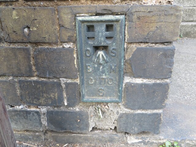
Image: © Peter Wood Taken: 10 Oct 2021
This bracket can be found on a roadside wall in Station Road, Potton. The recorded details give a height of 41.7457 metres above sea level. For more details see : https://www.bench-marks.org.uk/bm12512
Images are licensed for reuse under creativecommons.org/licenses/by-sa/2.0
Image Location
Latitude
52.126885
Longitude
-0.21728