Old Boundary Markers on the B3022 St Leonard's Road in Windsor
Introduction
The photograph on this page of Old Boundary Markers on the B3022 St Leonard's Road in Windsor by M Bardell as part of the Geograph project.
The Geograph project started in 2005 with the aim of publishing, organising and preserving representative images for every square kilometre of Great Britain, Ireland and the Isle of Man.

There are currently over 7.5m images from over 14,400 individuals and you can help contribute to the project by visiting https://www.geograph.org.uk
Old Boundary Markers on the B3022 St Leonard's Road in Windsor
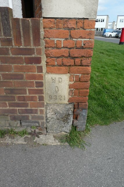
Image: © M Bardell Taken: 10 Mar 2022
Two War Department Boundary Markers set in the corner of the front garden wall of No.182, on the B3022 St Leonard's Road in Windsor, the former gate of the military hospital. Milestone Society National ID: BE_WDWIND21em
Images are licensed for reuse under creativecommons.org/licenses/by-sa/2.0
Image Location
Latitude
51.471139
Longitude
-0.61825