Old Boundary Marker on Station Road, Thorpe on the Hill
Introduction
The photograph on this page of Old Boundary Marker on Station Road, Thorpe on the Hill by B Westlake as part of the Geograph project.
The Geograph project started in 2005 with the aim of publishing, organising and preserving representative images for every square kilometre of Great Britain, Ireland and the Isle of Man.

There are currently over 7.5m images from over 14,400 individuals and you can help contribute to the project by visiting https://www.geograph.org.uk
Old Boundary Marker on Station Road, Thorpe on the Hill
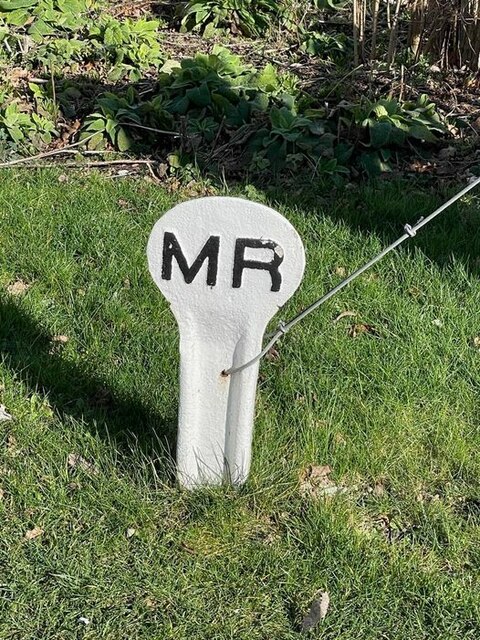
Image: © B Westlake Taken: 24 Feb 2022
Midland Railway Boundary Marker in the front garden of Safari, 1 Station Road, the former signalman's cottage. Thorpe on the Hill parish. Milestone Society National ID: LI_MRTHOR01em
Images are licensed for reuse under creativecommons.org/licenses/by-sa/2.0
Image Location


Leaflet Map data © OpenStreetMap
Latitude
53.187645
Longitude
-0.651218