Weir on Midgelden Brook at Gorpley Mill Site
Introduction
The photograph on this page of Weir on Midgelden Brook at Gorpley Mill Site by Kevin Waterhouse as part of the Geograph project.
The Geograph project started in 2005 with the aim of publishing, organising and preserving representative images for every square kilometre of Great Britain, Ireland and the Isle of Man.

There are currently over 7.5m images from over 14,400 individuals and you can help contribute to the project by visiting https://www.geograph.org.uk
Weir on Midgelden Brook at Gorpley Mill Site
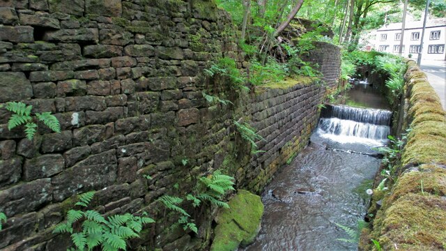
Image: © Kevin Waterhouse Taken: 9 Jun 2021
The stream is enclosed by walls of the former Gorpley Mill and the A681 Bacup Road. A culvert feeds the water from Halshaw Clough under the houses and road into the stream above this weir
Images are licensed for reuse under creativecommons.org/licenses/by-sa/2.0
Image Location
Latitude
53.708938
Longitude
-2.125402