
Cutcombe: Summerway Cross
Introduction
The photograph on this page of Cutcombe: Summerway Cross by Martin Bodman as part of the Geograph project.
The Geograph project started in 2005 with the aim of publishing, organising and preserving representative images for every square kilometre of Great Britain, Ireland and the Isle of Man.

There are currently over 7.5m images from over 14,400 individuals and you can help contribute to the project by visiting https://www.geograph.org.uk
Cutcombe: Summerway Cross
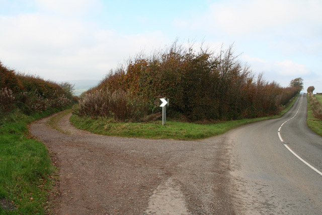
Image: © Martin Bodman Taken: 27 Oct 2005
On the left is the ‘Hare Path’ or herepath. S H Burton, writing in 1969, saw this as one of the country’s most significant and ancient trackways. He claimed that it once linked Bristol and Gloucester with Barnstaple and Cornwall by way of the Quantocks, Exford and Simonsbath. Apparently the Saxons adopted the old route so that they could control the high ground to which they had driven the Celts, while they themselves occupied the lowland farmsteads. Here the track forms the boundary between Cutcome and Exton parishes. On the right the present-day road runs to Wheddon Cross. See Image for another view of the track west of Simonsbath
Images are licensed for reuse under creativecommons.org/licenses/by-sa/2.0
Image Location

Latitude
51.127653
Longitude
-3.530449