Old Boundary Marker on Cornwall Road, Harrogate
Introduction
The photograph on this page of Old Boundary Marker on Cornwall Road, Harrogate by M Hatton as part of the Geograph project.
The Geograph project started in 2005 with the aim of publishing, organising and preserving representative images for every square kilometre of Great Britain, Ireland and the Isle of Man.

There are currently over 7.5m images from over 14,400 individuals and you can help contribute to the project by visiting https://www.geograph.org.uk
Old Boundary Marker on Cornwall Road, Harrogate
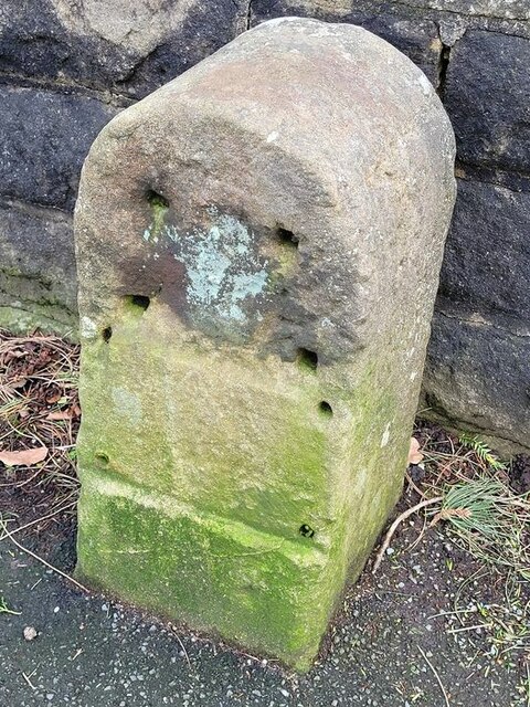
Image: © M Hatton Taken: 28 Feb 2022
Municipal Boundary Marker against a stone wall on the south side of Cornwall Road, formerly Irongate Bridge Road, Harrogate. First marked on the 1891 OS map when it was in Pannal parish on the boundary of Harrogate municipal borough, which boundary was established in 1884. By 1894 the part of Pannal in the borough had become part of Harrogate parish. Milestone Society National ID: YW_HARR02pb
Images are licensed for reuse under creativecommons.org/licenses/by-sa/2.0
Image Location
Latitude
53.99114
Longitude
-1.555628