Onto the Brent Road
Introduction
The photograph on this page of Onto the Brent Road by Neil Owen as part of the Geograph project.
The Geograph project started in 2005 with the aim of publishing, organising and preserving representative images for every square kilometre of Great Britain, Ireland and the Isle of Man.

There are currently over 7.5m images from over 14,400 individuals and you can help contribute to the project by visiting https://www.geograph.org.uk
Onto the Brent Road
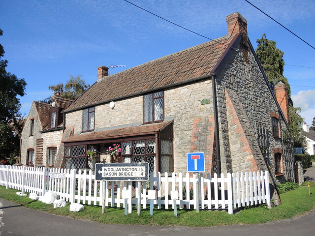
Image: © Neil Owen Taken: 14 Oct 2021
This buttressed cottage stands at the junction of Manor Road and Brent Road, guiding travellers with a pre-Worboys sign. The cul-de-sac to the right is now much longer now after an expansion of housing in the village.
Images are licensed for reuse under creativecommons.org/licenses/by-sa/2.0
Image Location
Latitude
51.160665
Longitude
-2.92032