Canterbury features [60]
Introduction
The photograph on this page of Canterbury features [60] by Michael Dibb as part of the Geograph project.
The Geograph project started in 2005 with the aim of publishing, organising and preserving representative images for every square kilometre of Great Britain, Ireland and the Isle of Man.

There are currently over 7.5m images from over 14,400 individuals and you can help contribute to the project by visiting https://www.geograph.org.uk
Canterbury features [60]
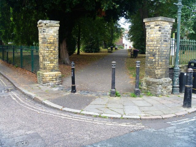
Image: © Michael Dibb Taken: 9 Sep 2021
From Castle Street, this is the gateway to the former churchyard of St Mary de Castro church. The church was built circa 618 and had been demolished by 1684 and the parish had been united with the nearby church of St Mildred. The gravestones along the wall are 18th and 19th century when the park was a burial ground for St Mildred's. The bollards seen here are listed, grade II, with details at: https://historicengland.org.uk/listing/the-list/list-entry/1260152 Canterbury is a small historic city on the River Stour in Kent, some 54 miles southeast of London. Occupied since prehistoric times, it became an important Roman city. In 672, the see of Canterbury gained authority over the entire English Church. After the murder of Archbishop Thomas Becket at the cathedral in 1170, pilgrims from all parts of Christendom came to visit his shrine until the Dissolution. Today, Canterbury is a popular tourist destination and one of the most-visited cities in the United Kingdom. The city has a substantial student population, with four university campuses.
Images are licensed for reuse under creativecommons.org/licenses/by-sa/2.0
Image Location


Leaflet Map data © OpenStreetMap
Latitude
51.276546
Longitude
1.076479