Canterbury houses [246]
Introduction
The photograph on this page of Canterbury houses [246] by Michael Dibb as part of the Geograph project.
The Geograph project started in 2005 with the aim of publishing, organising and preserving representative images for every square kilometre of Great Britain, Ireland and the Isle of Man.

There are currently over 7.5m images from over 14,400 individuals and you can help contribute to the project by visiting https://www.geograph.org.uk
Canterbury houses [246]
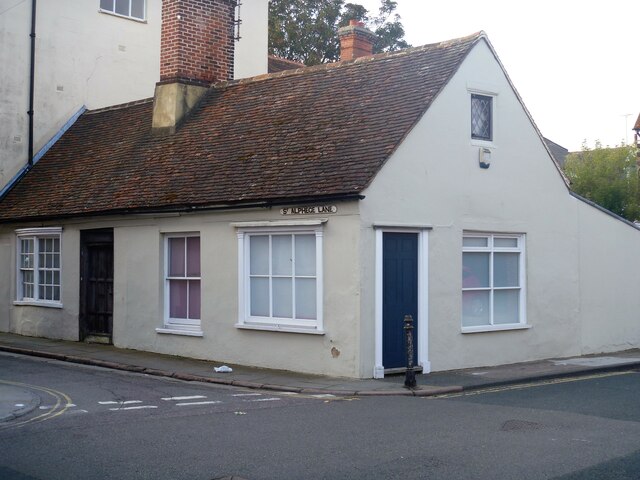
Image: © Michael Dibb Taken: 10 Sep 2021
Number 8 St Alphege Lane is also number 52 King Street. This is a 17th century building, now faced with stucco, originally a 2-storey building, the upper floor has been demolished. Tiled roof. Both rooms in the house have early 17th century plaster ceilings. Listed, grade II, with details at: https://historicengland.org.uk/listing/the-list/list-entry/1240917 Canterbury is a small historic city on the River Stour in Kent, some 54 miles southeast of London. Occupied since prehistoric times, it became an important Roman city. In 672, the see of Canterbury gained authority over the entire English Church. After the murder of Archbishop Thomas Becket at the cathedral in 1170, pilgrims from all parts of Christendom came to visit his shrine until the Dissolution. Today, Canterbury is a popular tourist destination and one of the most-visited cities in the United Kingdom. The city has a substantial student population, with four university campuses.
Images are licensed for reuse under creativecommons.org/licenses/by-sa/2.0
Image Location
Latitude
51.280942
Longitude
1.080359