Flood defence works in Flexbury
Introduction
The photograph on this page of Flood defence works in Flexbury by David Hawgood as part of the Geograph project.
The Geograph project started in 2005 with the aim of publishing, organising and preserving representative images for every square kilometre of Great Britain, Ireland and the Isle of Man.

There are currently over 7.5m images from over 14,400 individuals and you can help contribute to the project by visiting https://www.geograph.org.uk
Flood defence works in Flexbury
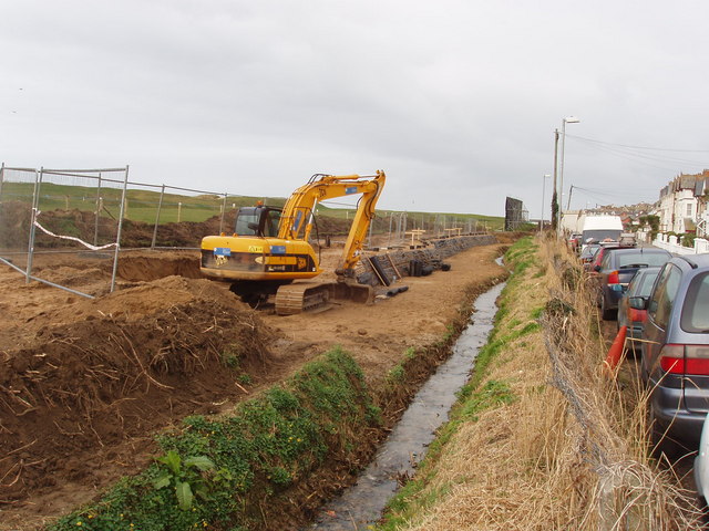
Image: © David Hawgood Taken: 27 Feb 2008
This view is along the Golf Course stream beside Downs View Road. Because there has been flooding where this stream joins the Crooklets Stream, and further up Crooklets Stream, the capacity of this Golf Course stream is being increased. Crooklets Stream goes through and around Flexbury; some water from it will be diverted to the Golf Course stream. See also Image
Images are licensed for reuse under creativecommons.org/licenses/by-sa/2.0
Image Location


Leaflet Map data © OpenStreetMap
Latitude
50.834891
Longitude
-4.546538