Ordnance Survey bench mark
Introduction
The photograph on this page of Ordnance Survey bench mark by Richard Sutcliffe as part of the Geograph project.
The Geograph project started in 2005 with the aim of publishing, organising and preserving representative images for every square kilometre of Great Britain, Ireland and the Isle of Man.

There are currently over 7.5m images from over 14,400 individuals and you can help contribute to the project by visiting https://www.geograph.org.uk
Ordnance Survey bench mark
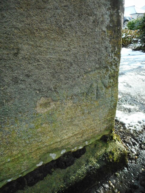
Image: © Richard Sutcliffe Taken: 24 Feb 2022
The rather faint bench mark is located low down on the corner pier of the wall, just to the south of Kelvin Timber on Main Street, Milngavie Image Above it is a blue plaque commemorating George Bennie. The benchmark marks a height of 40.0768m above Ordnance Datum (Newlyn) last verified and levelled in 1969.
Images are licensed for reuse under creativecommons.org/licenses/by-sa/2.0
Image Location
Latitude
55.931849
Longitude
-4.316334