Bridge number 10
Introduction
The photograph on this page of Bridge number 10 by Adrian Taylor as part of the Geograph project.
The Geograph project started in 2005 with the aim of publishing, organising and preserving representative images for every square kilometre of Great Britain, Ireland and the Isle of Man.

There are currently over 7.5m images from over 14,400 individuals and you can help contribute to the project by visiting https://www.geograph.org.uk
Bridge number 10
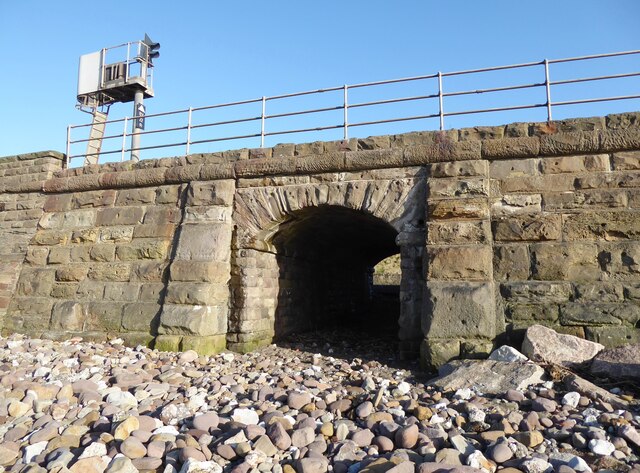
Image: © Adrian Taylor Taken: 21 Feb 2022
Parton was originally a fishing community and it was cut off from the sea when the Whitehaven Junction Railway was opened in 1847. Several small bridges were constructed to allow passage from the village to the shore. This one is bridge number 10, with the national identifier CBC2/10 (Carnforth-Barrow-Carlisle section 2 bridge number 10). The signal number BY22R is for the down (northbound) line towards Carlisle and is controlled from Bransty Signalbox at Whitehaven. The signal head is angled to allow adequate sighting on this sharply curved section of track.
Images are licensed for reuse under creativecommons.org/licenses/by-sa/2.0
Image Location
Latitude
54.568803
Longitude
-3.582905