Housing on Roger Dudman Way
Introduction
The photograph on this page of Housing on Roger Dudman Way by Stephen Craven as part of the Geograph project.
The Geograph project started in 2005 with the aim of publishing, organising and preserving representative images for every square kilometre of Great Britain, Ireland and the Isle of Man.

There are currently over 7.5m images from over 14,400 individuals and you can help contribute to the project by visiting https://www.geograph.org.uk
Housing on Roger Dudman Way
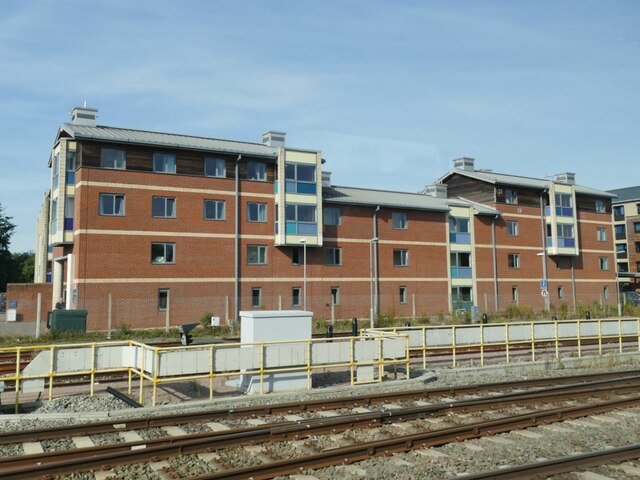
Image: © Stephen Craven Taken: 21 Sep 2021
Viewed from a train approaching Oxford station. A Council planning document available online explains that Roger Dudman Way is a 1.2ha brownfield site occupying the location of former railway sidings Image Construction of post-graduate student accommodation started in the early 2000s and an application for more such housing was approved in 2013. This is 'B' block, so I presume part of the earlier phase of development. See also Image
Images are licensed for reuse under creativecommons.org/licenses/by-sa/2.0
Image Location
Latitude
51.758627
Longitude
-1.27278