By-weir overspill at Wightwick Mill lock
Introduction
The photograph on this page of By-weir overspill at Wightwick Mill lock by Richard Law as part of the Geograph project.
The Geograph project started in 2005 with the aim of publishing, organising and preserving representative images for every square kilometre of Great Britain, Ireland and the Isle of Man.

There are currently over 7.5m images from over 14,400 individuals and you can help contribute to the project by visiting https://www.geograph.org.uk
By-weir overspill at Wightwick Mill lock
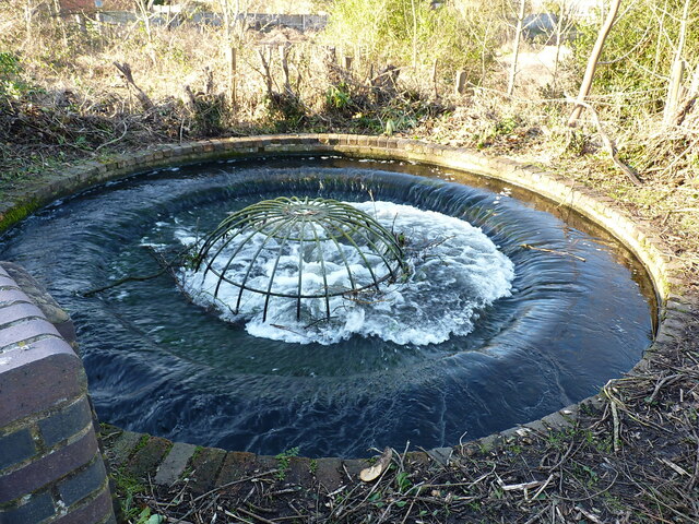
Image: © Richard Law Taken: 4 Feb 2022
Very similar in design to the next one 'upstream' Image and built to take excess water from the upper canal pound to the lower one, bypassing the lock at Wightwick Mill. Rather oddly, this one doesn't make an appearance in the Grade II listing given to the lock and bridge here.
Images are licensed for reuse under creativecommons.org/licenses/by-sa/2.0
Image Location


Leaflet Map data © OpenStreetMap
Latitude
52.583894
Longitude
-2.184591