Whitehaven Tunnel
Introduction
The photograph on this page of Whitehaven Tunnel by Adrian Taylor as part of the Geograph project.
The Geograph project started in 2005 with the aim of publishing, organising and preserving representative images for every square kilometre of Great Britain, Ireland and the Isle of Man.

There are currently over 7.5m images from over 14,400 individuals and you can help contribute to the project by visiting https://www.geograph.org.uk
Whitehaven Tunnel
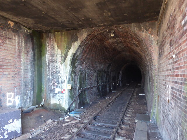
Image: © Adrian Taylor Taken: 21 Feb 2022
The north entrance of Whitehaven Tunnel; the end of the platform ramp of Platform 2 of Whitehaven Station (photograph Image) is visible in the right foreground (see also photographs Image and Image). The small antenna visible at the crown of the brick arch is to permit two way communication with trains in the tunnel. The England Coast Path and National Cycle Route 72 pass over the flat roofed section of the tunnel in the foreground.
Images are licensed for reuse under creativecommons.org/licenses/by-sa/2.0
Image Location
Latitude
54.552698
Longitude
-3.586224