OS benchmark - Compton, former milestone
Introduction
The photograph on this page of OS benchmark - Compton, former milestone by Richard Law as part of the Geograph project.
The Geograph project started in 2005 with the aim of publishing, organising and preserving representative images for every square kilometre of Great Britain, Ireland and the Isle of Man.

There are currently over 7.5m images from over 14,400 individuals and you can help contribute to the project by visiting https://www.geograph.org.uk
OS benchmark - Compton, former milestone
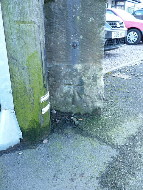
Image: © Richard Law Taken: 4 Feb 2022
An OS cutmark low on the eastern face of the former Compton milestone, last levelled in 1957 at 102.303m above Ordnance Datum Newlyn. It was originally cut as part of the 1st Geodetic Levelling survey, and recorded at 336.5ft above Liverpool datum.
Images are licensed for reuse under creativecommons.org/licenses/by-sa/2.0
Image Location
Latitude
52.585296
Longitude
-2.178929