Canterbury features [51]
Introduction
The photograph on this page of Canterbury features [51] by Michael Dibb as part of the Geograph project.
The Geograph project started in 2005 with the aim of publishing, organising and preserving representative images for every square kilometre of Great Britain, Ireland and the Isle of Man.

There are currently over 7.5m images from over 14,400 individuals and you can help contribute to the project by visiting https://www.geograph.org.uk
Canterbury features [51]
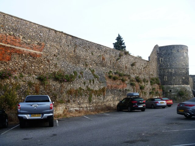
Image: © Michael Dibb Taken: 13 Sep 2021
Along Broad Street, stands an impressive run of the city walls. First built by the Romans and retained by the Anglo-Saxons, defending Canterbury against the Vikings. Fearing a French invasion in 1363, the walls were rebuilt in stone, incorporating the older walls where they still remained. Pressure from urban development in the 18th and 19th centuries led to extensive parts of the walled circuit being demolished. German bombing during the Second World War caused further damage. Despite this, the remaining walls and gatehouse survived the post-war redevelopment intact, and some portions were rebuilt entirely. Over half the original circuit survives, enclosing an area of 130 acres. A Scheduled Ancient Monument with details at: https://historicengland.org.uk/listing/the-list/list-entry/1003554 Canterbury is a small historic city on the River Stour in Kent, some 54 miles southeast of London. Occupied since prehistoric times, it became an important Roman city. In 672, the see of Canterbury gained authority over the entire English Church. After the murder of Archbishop Thomas Becket at the cathedral in 1170, pilgrims from all parts of Christendom came to visit his shrine until the Dissolution. Today, Canterbury is a popular tourist destination and one of the most-visited cities in the United Kingdom. The city has a substantial student population, with four university campuses.
Images are licensed for reuse under creativecommons.org/licenses/by-sa/2.0
Image Location
Latitude
51.279193
Longitude
1.085261