Boskerris Woollas house, Carbis Bay
Introduction
The photograph on this page of Boskerris Woollas house, Carbis Bay by Richard Law as part of the Geograph project.
The Geograph project started in 2005 with the aim of publishing, organising and preserving representative images for every square kilometre of Great Britain, Ireland and the Isle of Man.

There are currently over 7.5m images from over 14,400 individuals and you can help contribute to the project by visiting https://www.geograph.org.uk
Boskerris Woollas house, Carbis Bay
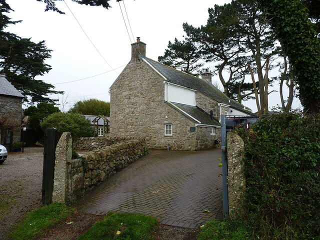
Image: © Richard Law Taken: 24 Dec 2021
A rear view of this fine house, built in the late 18th century, primarily of dressed granite blocks. It attracted a Grade II listing https://britishlistedbuildings.co.uk/101136949-boskerris-woollas-st-ives#.Yg1dGN_P3IU & https://historicengland.org.uk/listing/the-list/list-entry/1136949 in 1972.
Images are licensed for reuse under creativecommons.org/licenses/by-sa/2.0
Image Location
Latitude
50.192077
Longitude
-5.467653