Waterbarn Baptist Chapel at risk
Introduction
The photograph on this page of Waterbarn Baptist Chapel at risk by Kevin Waterhouse as part of the Geograph project.
The Geograph project started in 2005 with the aim of publishing, organising and preserving representative images for every square kilometre of Great Britain, Ireland and the Isle of Man.

There are currently over 7.5m images from over 14,400 individuals and you can help contribute to the project by visiting https://www.geograph.org.uk
Waterbarn Baptist Chapel at risk
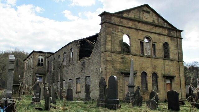
Image: © Kevin Waterhouse Taken: 14 Apr 2021
The Grade II listed building appears at risk of collapse viewed from Brandwood Road
Images are licensed for reuse under creativecommons.org/licenses/by-sa/2.0
Image Location
Latitude
53.690797
Longitude
-2.234985