Nant-y-Gwenill
Introduction
The photograph on this page of Nant-y-Gwenill by Mike Parker as part of the Geograph project.
The Geograph project started in 2005 with the aim of publishing, organising and preserving representative images for every square kilometre of Great Britain, Ireland and the Isle of Man.

There are currently over 7.5m images from over 14,400 individuals and you can help contribute to the project by visiting https://www.geograph.org.uk
Nant-y-Gwenill
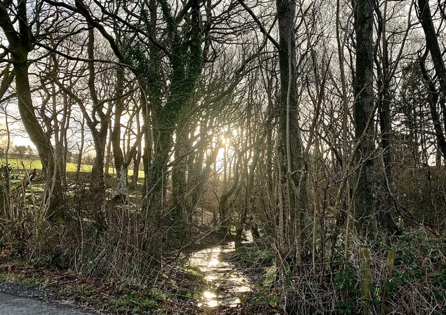
Image: © Mike Parker Taken: 11 Feb 2022
Winter morning sunlight catches the tiny stream of Nant-y-Gwenill. The map shows a footpath running along its bank through the wood, though there is no evidence of that on the ground.
Images are licensed for reuse under creativecommons.org/licenses/by-sa/2.0
Image Location
Latitude
52.571621
Longitude
-3.763519