Red Rocks, Wepre Park
Introduction
The photograph on this page of Red Rocks, Wepre Park by Eirian Evans as part of the Geograph project.
The Geograph project started in 2005 with the aim of publishing, organising and preserving representative images for every square kilometre of Great Britain, Ireland and the Isle of Man.

There are currently over 7.5m images from over 14,400 individuals and you can help contribute to the project by visiting https://www.geograph.org.uk
Red Rocks, Wepre Park
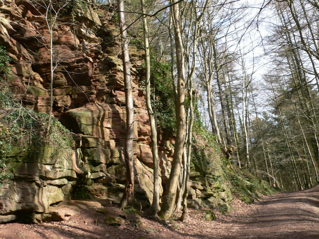
Image: © Eirian Evans Taken: 1 Mar 2008
Hard sandstone (or millstone grit) outcrop in Wepre Park. This was the stone used to construct Ewloe Castle at the southern end of the woodland. This is red sandstone, typical of many sandstone outcrops in this area, the red colour caused by oxidised iron. They are an indication of possible coal seams lower down, and Wepre Park has many small surface pits which were dug by hand.
Images are licensed for reuse under creativecommons.org/licenses/by-sa/2.0
Image Location


Leaflet Map data © OpenStreetMap
Latitude
53.202254
Longitude
-3.062055