Descent into Knighton
Introduction
The photograph on this page of Descent into Knighton by Graham Horn as part of the Geograph project.
The Geograph project started in 2005 with the aim of publishing, organising and preserving representative images for every square kilometre of Great Britain, Ireland and the Isle of Man.

There are currently over 7.5m images from over 14,400 individuals and you can help contribute to the project by visiting https://www.geograph.org.uk
Descent into Knighton
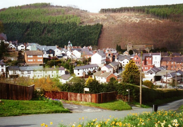
Image: © Graham Horn Taken: 20 Apr 2000
For northbound walkers on Offa's Dyke Path, this sight is a welcome relief as it probably means end of the day. But they can also see that Panpunton Hill behind the town will be a stiff climb first thing in the morning.
Images are licensed for reuse under creativecommons.org/licenses/by-sa/2.0
Image Location
Latitude
52.345381
Longitude
-3.047781