Walker's nightmare
Introduction
The photograph on this page of Walker's nightmare by Anthony O'Neil as part of the Geograph project.
The Geograph project started in 2005 with the aim of publishing, organising and preserving representative images for every square kilometre of Great Britain, Ireland and the Isle of Man.

There are currently over 7.5m images from over 14,400 individuals and you can help contribute to the project by visiting https://www.geograph.org.uk
Walker's nightmare
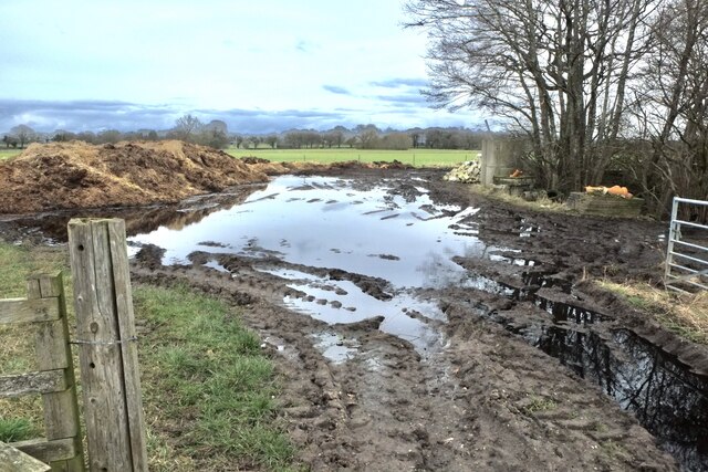
Image: © Anthony O'Neil Taken: 11 Feb 2022
If you pursue the path on the map, from Gale Moss to Lodge Lane, this is what will greet you. The designated path is to the left: it continues as a farm track to the right, beyond the trees. The pond is impassable without waders and the farmer has dumped tens of tons of silage over the path. To continue your walk, you will need to climb over the six-foot piles to reach the track!
Images are licensed for reuse under creativecommons.org/licenses/by-sa/2.0
Image Location
Latitude
53.325178
Longitude
-2.512221