Rounded pilaster
Introduction
The photograph on this page of Rounded pilaster by Adrian Taylor as part of the Geograph project.
The Geograph project started in 2005 with the aim of publishing, organising and preserving representative images for every square kilometre of Great Britain, Ireland and the Isle of Man.

There are currently over 7.5m images from over 14,400 individuals and you can help contribute to the project by visiting https://www.geograph.org.uk
Rounded pilaster
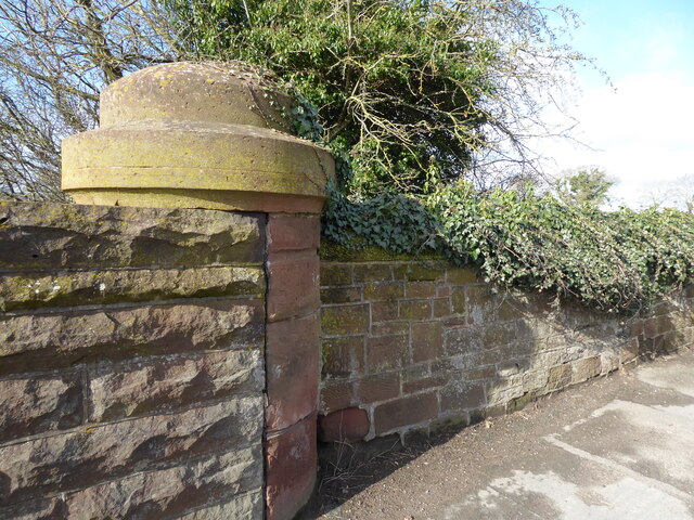
Image: © Adrian Taylor Taken: 25 Feb 2021
Rounded pilasters with substantial sandstone caps at the end of the parapet walls are a feature of the original bridges over the Maryport and Carlisle section of the Cumbria Coast Line. There is an Ordnance Survey cut benchmark on the face of the wall to the right of the pilaster (photograph Image).
Images are licensed for reuse under creativecommons.org/licenses/by-sa/2.0
Image Location
Latitude
54.84812
Longitude
-2.980536