At the corner, Wood Nook Lane, Honley
Introduction
The photograph on this page of At the corner, Wood Nook Lane, Honley by Humphrey Bolton as part of the Geograph project.
The Geograph project started in 2005 with the aim of publishing, organising and preserving representative images for every square kilometre of Great Britain, Ireland and the Isle of Man.

There are currently over 7.5m images from over 14,400 individuals and you can help contribute to the project by visiting https://www.geograph.org.uk
At the corner, Wood Nook Lane, Honley
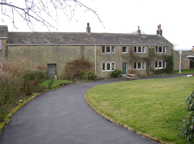
Image: © Humphrey Bolton Taken: 28 Feb 2008
This is probably the building that is shown here on a map of 1788, at which time it was in the township and manor of Honley. It has house and barn under one roof, but on this side at least the barn does not have the usual arched cart entrance.
Images are licensed for reuse under creativecommons.org/licenses/by-sa/2.0
Image Location


Leaflet Map data © OpenStreetMap
Latitude
53.591841
Longitude
-1.818668