Old Boundary Marker on the B2170 Military Road in Sandgate
Introduction
The photograph on this page of Old Boundary Marker on the B2170 Military Road in Sandgate by P Collins as part of the Geograph project.
The Geograph project started in 2005 with the aim of publishing, organising and preserving representative images for every square kilometre of Great Britain, Ireland and the Isle of Man.

There are currently over 7.5m images from over 14,400 individuals and you can help contribute to the project by visiting https://www.geograph.org.uk
Old Boundary Marker on the B2170 Military Road in Sandgate
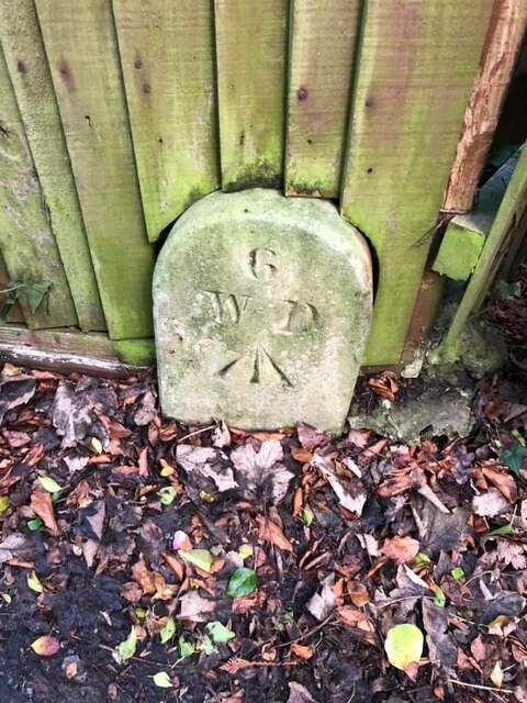
Image: © P Collins Taken: 6 Feb 2022
War Department Boundary Marker against a wooden fence on the east side of the B2170 Military Road. Sandgate parish. Inscribed 6 / W D / ↑. Stone number 6 is marked at TR2017435642 on old OS maps. Marking the boundary of Shorncliffe Camp. Milestone Society National ID: KE_WDSAND06em
Images are licensed for reuse under creativecommons.org/licenses/by-sa/2.0
Image Location
Latitude
51.078054
Longitude
1.141564