Muirtown Locks, 1998
Introduction
The photograph on this page of Muirtown Locks, 1998 by Alan Murray-Rust as part of the Geograph project.
The Geograph project started in 2005 with the aim of publishing, organising and preserving representative images for every square kilometre of Great Britain, Ireland and the Isle of Man.

There are currently over 7.5m images from over 14,400 individuals and you can help contribute to the project by visiting https://www.geograph.org.uk
Muirtown Locks, 1998
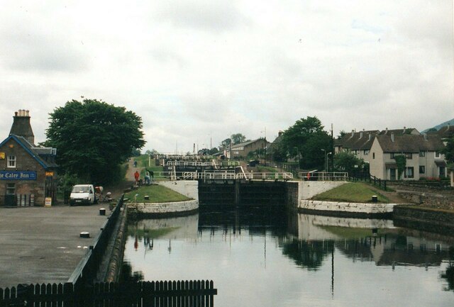
Image: © Alan Murray-Rust Taken: 16 Jun 1998
Looking up the flight from the swing bridge. The Caley Inn on the left originated as a pair of lock keeper's cottages but at the time of writing has been disused since around 2008, despite a later planning permission for residential/restaurant use.
Images are licensed for reuse under creativecommons.org/licenses/by-sa/2.0
Image Location
Latitude
57.481828
Longitude
-4.248137