Benchmark, Scotland Road
Introduction
The photograph on this page of Benchmark, Scotland Road by Adrian Taylor as part of the Geograph project.
The Geograph project started in 2005 with the aim of publishing, organising and preserving representative images for every square kilometre of Great Britain, Ireland and the Isle of Man.

There are currently over 7.5m images from over 14,400 individuals and you can help contribute to the project by visiting https://www.geograph.org.uk
Benchmark, Scotland Road
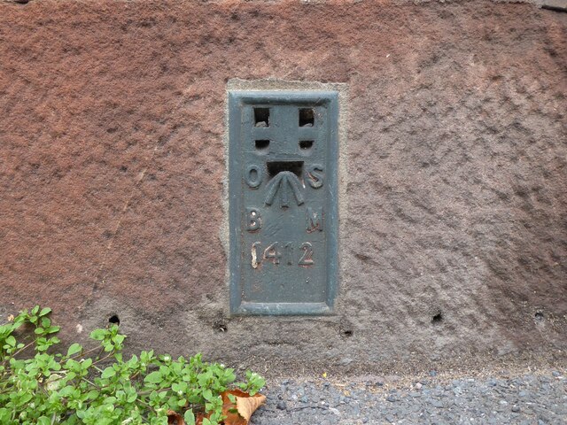
Image: © Adrian Taylor Taken: 10 Sep 2020
Mounted on the corner of the former Grey Bull Inn, now a private house, this Ordnance Survey flush bracket benchmark number 1412 marks a height of 148.9143m above sea level (Ordnance Datum Newlyn) last levelled in 1953 and verified in 1972 (location photograph Image).
Images are licensed for reuse under creativecommons.org/licenses/by-sa/2.0
Image Location
Latitude
54.670305
Longitude
-2.760373