Former Town Hall, Liversedge
Introduction
The photograph on this page of Former Town Hall, Liversedge by Humphrey Bolton as part of the Geograph project.
The Geograph project started in 2005 with the aim of publishing, organising and preserving representative images for every square kilometre of Great Britain, Ireland and the Isle of Man.

There are currently over 7.5m images from over 14,400 individuals and you can help contribute to the project by visiting https://www.geograph.org.uk
Former Town Hall, Liversedge
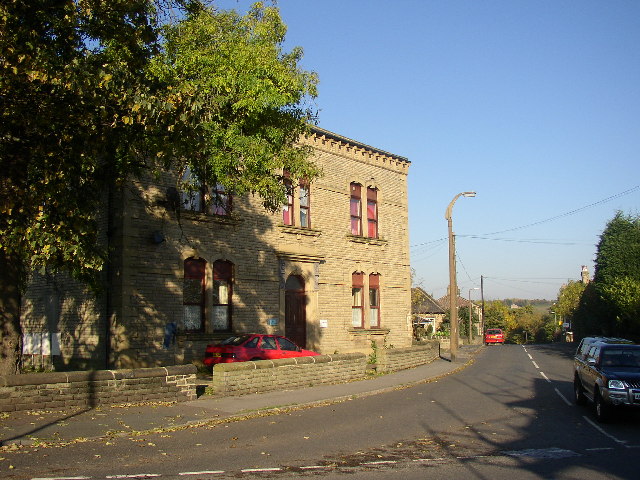
Image: © Humphrey Bolton Taken: 27 Oct 2005
From 1894 to 1915, when it joined with its neighbouring authorities to form Spenborough UDC, Liversedge was an Urban District Council and this was the Town Hall. It is at the junction of Knowler Hill with Halifax Road.
Images are licensed for reuse under creativecommons.org/licenses/by-sa/2.0
Image Location
Latitude
53.710243
Longitude
-1.698474